Notice of Temporary Trail Closure: Hacketts Gully
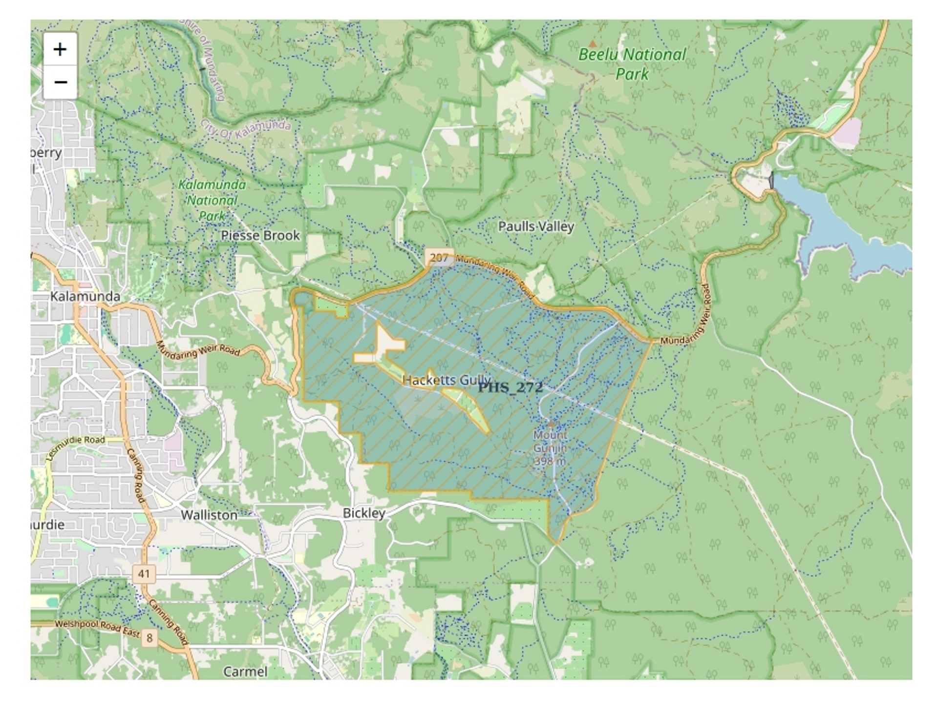
The Department of Biodiversity, Conservation and Attractions (DBCA) – Perth Hills District will be conducting a prescribed burn in the Hacketts Gully area (PHS_272), which includes parts of the Kalamunda Mountain Biking Circuit. The burn will affect areas south of Mundaring Weir Road only.
To ensure public safety, the following locations closed from 2pm on Tuesday, 21 October 2025, and will remain closed for approximately 2–3 weeks prior to the burn:
- Gungin Road trailhead
- Gungin Road carpark
- Kalamunda Circuit carpark
- Black Stump pump track
- All mountain bike trails south of Mundaring Weir Road
Prescribed burns are a vital part of bushfire risk management. They help:
- Reduce fuel loads in parks, forests, and reserves
- Minimise the impact of bushfires
- Protect lives, homes, trails, and recreational assets
Current mild spring conditions provide an ideal window for this burn to be carried out safely.
For your safety, do not enter the burn area. Hazards may include:
- Active fire
- Falling trees
- Overhead risks
DBCA will inspect all affected trails and facilities before reopening to ensure they are safe for public use.
Stay Updated
Trail closure updates will be posted on DBCA’s Park Alerts System via the Parks and Wildlife Service.
Thank you for your understanding and cooperation.